|
Canyoneering Scenic Creeks in
Arizona
Do you tire of
crowded maintained hiking trails? Have you
ever looked down into a deep canyon and felt
a strong desire to hike into such a place? A
desire that pulls you just around the next
bend because the pool might be bigger or
deeper? Maybe a waterfall is just ahead, or
hidden rock art on canyon walls.
We know that many of you will not be
interested in venturing into these unknown
remote and scenic places.
But... for those of you that are unusually
drawn to deep canyons and flowing streams,
this page is for you!
Never explore canyons during rainy periods,
because of flash flooding.
I love to seek
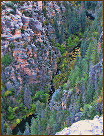
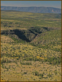
out and explore unique and scenic drainage's
within Arizona. A common theme that runs
through many of the Bradshaw hikes I
recommend, are perennial creeks. There are
literally hundreds and hundreds of such
locations throughout Arizona. Locating these
wild canyon gems can be directly attributed
to my work at the Arizona Game and Fish
Department, word of mouth, and simply
seeking them out using maps.
For me, Canyoneering has been defined as
traveling canyons in search of perennial or
intermittent creeks and is commonly done in
remote and rugged areas and often requires
navigational / route finding techniques and
other wilderness travel skills. For me, I am
exploring a canyon for the amazing scenery,
flowing water, wildlife viewing and
photographic opportunities. Oh yes and
sometimes fly fishing for wild trout.
Canyoneering requires the following skills.
Canyoneering:
-
Hiking/Backpacking
-
Scrambling
-
Climbing
-
Jumping
-
Swimming
-
Non
technical repelling
-
Camping in remote
areas
 In
recent years Canyoneering has been
re-defined. I refer to this activity instead
as Technical Canyoneering. It is usually
done as a group activity for safety reasons,
while dressed in climbing safety equipment.
Specific canyons are sought out that require
the below skills. A beautifully photographed
and award winning book on this subject is,
Grand Canyoneering by Todd Martin, and is
available for those who desire to learn
more. In
recent years Canyoneering has been
re-defined. I refer to this activity instead
as Technical Canyoneering. It is usually
done as a group activity for safety reasons,
while dressed in climbing safety equipment.
Specific canyons are sought out that require
the below skills. A beautifully photographed
and award winning book on this subject is,
Grand Canyoneering by Todd Martin, and is
available for those who desire to learn
more.
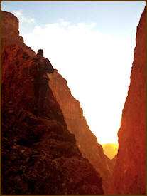
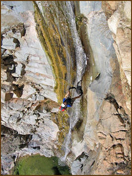
Technical Canyoneering
in Black Canyon. Photo courtesy of
Todd Martin
Technical Canyoneering:
-
Technical hiking
-
Technical
descents while rappelling
-
Knowledge
in rope work
-
Technical
climbing or down climbing
-
Technical
jumps
-
Technical
swims
-
Camping in remote
areas

 The
following is not a comprehensive list by
far, but simply a few of my favorite trips,
from the last 40 years. We have not provided
maps only names and nearby landmarks. We had
to search them out, so we will let you do
the same. We assure you, they are worth the
detective work. If you don't want to do some
detective work, in recent years books and
websites have been published giving
directions to more well known locations.
This is a good place to start if you have
never considered this type of hiking before.
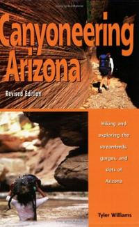
An excellent book listing some of these well
known locations is, Canyoneering
Arizona by Tyler Williams. The
following is not a comprehensive list by
far, but simply a few of my favorite trips,
from the last 40 years. We have not provided
maps only names and nearby landmarks. We had
to search them out, so we will let you do
the same. We assure you, they are worth the
detective work. If you don't want to do some
detective work, in recent years books and
websites have been published giving
directions to more well known locations.
This is a good place to start if you have
never considered this type of hiking before.
An excellent book listing some of these well
known locations is, Canyoneering
Arizona by Tyler Williams.
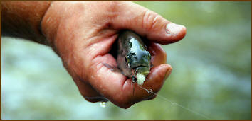
Fly Fishing
Small Creeks
Because of all
the questions and interest we have received
on pursuing wild fish within remote canyons
we have created this page for you hard core
fishers. Click
Here for more information.
Prior to the
fish stocking programs in the 1940's, an
extensive creek inventory was conducted for
healthy perennial and intermittent creeks in
Arizona. Some of these lonely creeks were
planted with trout after World War Two, and
a review of historical stocking records at
the Arizona Game and Fish Department will
reveal their locations.
Wild trout in these
creeks are usually small. Practice catch and
release.
Many still have fishable
trout populations, even today. Check laws to
see if they are open to fishing. Please
practice catch and release if you pursue
wild trout in these remote canyons.
If you have an interest in fishing lesser
know creeks in AZ consider our friend Ben's
website.
http://azwanderings.com
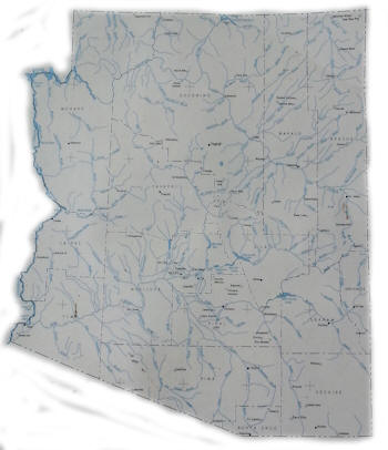
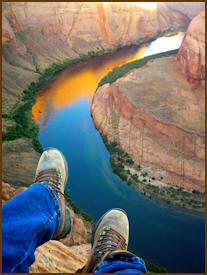
1987 map of
Arizona major waterways. Hundreds of other
springs and flowing creeks are not listed on
this map. Many are nearby and tributaries
to these major waterways.
Click Here for
map of Ephemeral and Perennial Streams in AZ
For a canyon or spring to
qualify for the below list it needs to have
what I call...
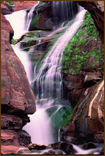
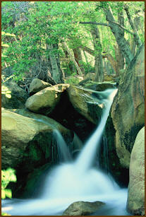
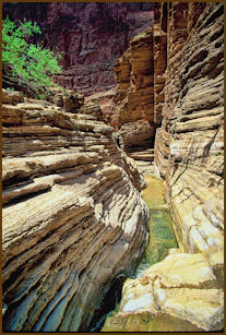
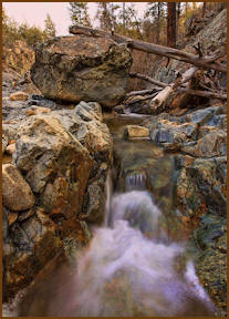
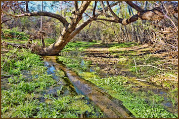
High Scenic Value and Unique
Features. Most of the below features need to
be present.
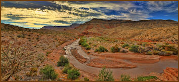
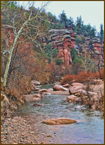
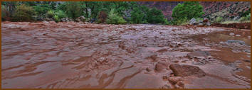
Virgin River,
northern AZ
High Scenic
Value and Unique Features
-
Solitude
-
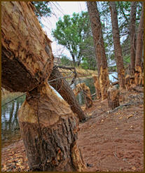
Riparian
plant communities
-
Flowing
water
-
Log
and rock jams
-
Fish
-
Waterfalls
and or cascades
-
Lots of
scenic beauty
-
Lots of
bird life
-
Other
wildlife
-
Pools or
ponds
-
Unusual
Rock Formations
-
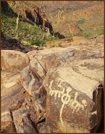
Indian
ruins & rock art
-
Old dams
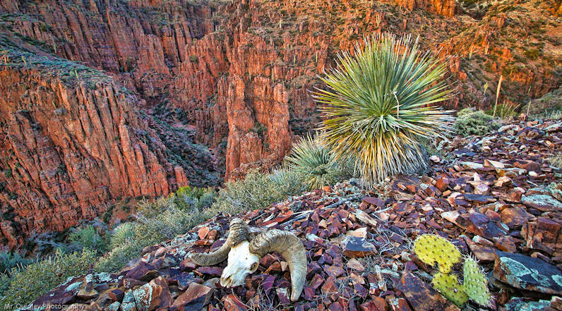
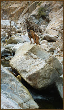
Coyote caught
in a recent flash flood within Waterholes
Canyon, northern AZ. Be especially careful
and never enter slot canyons during summer
monsoon season. Rain from storms miles
upstream can suddenly fill tightly walled
slot canyons.
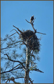
Capturing big
horn sheep in remote AZ Canyons article...
click here.
Known creeks
with High Scenic Value and Unique Features.
Many other
known creeks are not listed below, simply
because we have never been to them. Refer to
the many books and websites that provide additional
information on commonly known canyons.
-
Upper Wet Beaver Creek
-
Upper
Fossil Creek
-
Pumphouse
Wash ... near Oak Creek
-
West Fork
of Oak Creek... Sedona
-
Sycamore
Creek... near Cottonwood
-
Cave
Creek... Southern AZ
-
Thunder
River ... Grand Canyon Ntl Park
-
North
Creek... near House Rock Valley
-
Horton
Creek...Mogollom Rim
-
Verde River
... from Lava Falls to Horsehoe Lake,
best floated
-
Salt River
Canyon ... above Hwy 60
-
Tonto Creek
... in the wilderness
-
Paria
River... above the Colorado River
-
Aravaipa
River... permit required
-
Madara
Canyon...near Amado
-
Garden
Canyon...Fort Huachuca
-
Tulle
Creek...above Lake Pleasant
-
Black
Canyon... near Cottonwood
-
Chevelon
Creek... middle and lower stretches
-
W. Clear
Creek... below Willow Creek
-
E.
Clearcreek....below Blue Ridge Lake
-
Haigler
Creek... Near Rim Tank
-
Christopher
Creek... near R. Bar C Ranch
-
Water Holes
Canyon... near Echo Peaks
-
Workman
Creek...Sierra Ancha Mountains
Canyon bottoms
are difficult to walk in.
Unknown
Creeks with high scenic value and unique
features.
NOTE: Most of
these locations can be difficult to get to
and require long hikes with no trails to
follow. Some are accessible partly by
horseback or mountain bike, although most
are not, because of the rugged rocky
features and very thick riparian bottoms.
For some of these locations
only a small portion of the drainage may
have "High Scenic Value" and others may be
loaded up for miles. Some may be located
right next to major roads with easy access
such as the example below. A few will
require climbing or repelling skills if you
desire to go further.
Ash Creek a hike nearby
Interstate 17. Click here for more
information.
Be very
careful venturing into such locations and
never go alone. This type of hiking can be
dangerous.
Ash Creek
-
East Verde
River... Mazatzal Wilderness
-
Upper
Kaiser Spring Canyon... no water but
right along Hwy 93
-
Upper Burro
Creek... in the wilderness
-
Upper Verde
River... above and below Drake
-
Walnut
Creek ... above Big Chino Wash
-
Eagle
River...below Tulle Creek
-
Muldoon
Canyon ... Verde River drainage
-
Upper Fish
Creek
-
Upper Gila
River...above Bonita Creek
-
Middle
Turkey Creek ... above Cleator
-
Van Dam
Spring... North Kaibab
-
Virgin
River... near Utah border
-
Chimney
Creek
-
Saras Crack
... Lake Havasu City
-
Upper Big
Sandy River
-
Hassayampa
River... in the wilderness
-
Upper Black
and White Rivers.... on and off the
Reservation
-
Dragon
Wash.... Flagstaff
-
Munds
Canyon ... Munds Park
-
Lousy
Creek... Agua Fria Monument
-
Tank
Creek... Agua Fria Monument
-
Secret Pass
Spring... near Davis Dam
-
Trout
Creek... in the wilderness
-
Point of
Pines Creek ... Apache Indian
Reservation
-
South Fork
of Soap Creek (not flowing, just
cool)... Glen Canyon Rec area.
-
Fall
Creek... near Lake Powell
-
Canyon
Creek ... above fish hatchery
-
Squaw
Canyon... Parashant National Monument
-
Teec Nos
Pos Canyon - Carrizo Mountains
-
Markham
Creek ... near Goat Spring
-
Palm Canyon
(no water, just cool) Kofa WL Refuge and
well known
-
Bear Spring
...Saguaro National Park
-
Upper
Rattlesnake Canyon ... near Holdup
Springs
-
Carrizo
Creek .... down stream from the town
Carrizo
-
Upper
Hurricane Creek... near Mt Baldy
-
Parker
Creek ... Roosevelt Lake
-
Lee Valley
Creek.... above the Lake and below in
the canyon
-
Willow
Creek ... near Pius Draw
-
Gordon
Creek ... Hellsgate Wilderness
-
Deep
Creek... Sierra Ancha Wilderness
-
Deadman
Creek... above Mountain Spring
-
San Pedro
River...beaver reintroduction areas
-
Frye
Creek... North side of MT Graham
-
Big
Creek... near Snow Flat
-
Grant
Creek... near Fort Grant Vista
-
Ash
Creek... near Webb Peak
-
Chitty
Creek... near Natanes Plateau
-
Raspberry
Creek... near Blue
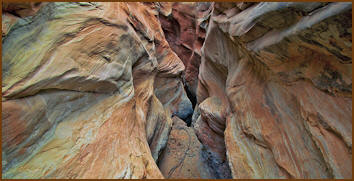
Big Water Slot Canyon,
northern AZ/UT border |