 |
||||||||||||||||||||||||||||||||||
| Home | Explore | FAQ | About Us | Contact Us | Links | |||||||||||||||||||||||||||||
|
||||||||||||||||||||||||||||||||||
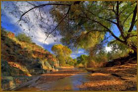
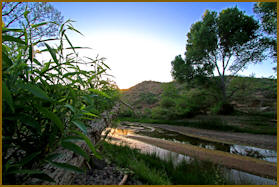
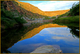
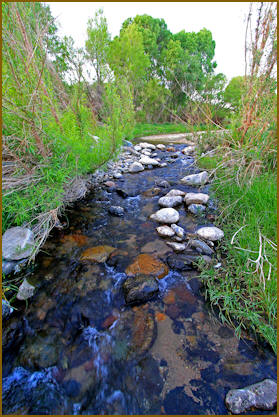
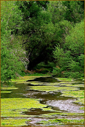
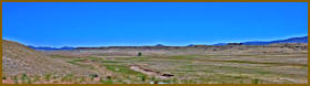
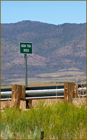
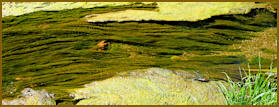
 The
Agua Fria River has its humble
beginnings in Prescott Valley. All
tributaries on the east and north side
of the Bradshaws enter it. It continues
for 120 miles before entering the Gila
River. This river like most in Arizona
has water that rises above ground and
flows and disappears underground at
other locations. Over the years I've
hiked and rode all sections except those
below Jomax Road in Phoenix to the Gila
River. The Agua Fria is seldom visited
by people except for Bloody Basin Road,
Badger Creek and Table Mesa Road where
it enters Lake Pleasant. My favorite
sections are between Chauncey Ranch and
Dewey, and Badger Creek to Black Canyon
City. There are several side tributaries
to explore like Lousy Creek and others
that hold populations of native fish. If
I had to recommend one section to visit
it would be the Badger Springs exit off
Interstate 17. A short mile long hike
downstream within pretty Badger Creek
will drop you into the River. In the
summer there is a deep swimming hole
here. One can hike downstream or up from
this point. Our map shows sections of
the Agua Fria that typically flow.
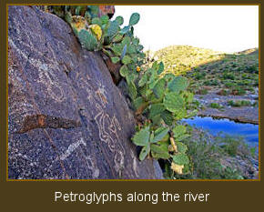
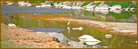
Diverse wildlife inhabit this river
system as well as many Indian
petroglyphs. When you hike take a trash
bag with and pick up any trash along the
way.
The
Agua Fria River has its humble
beginnings in Prescott Valley. All
tributaries on the east and north side
of the Bradshaws enter it. It continues
for 120 miles before entering the Gila
River. This river like most in Arizona
has water that rises above ground and
flows and disappears underground at
other locations. Over the years I've
hiked and rode all sections except those
below Jomax Road in Phoenix to the Gila
River. The Agua Fria is seldom visited
by people except for Bloody Basin Road,
Badger Creek and Table Mesa Road where
it enters Lake Pleasant. My favorite
sections are between Chauncey Ranch and
Dewey, and Badger Creek to Black Canyon
City. There are several side tributaries
to explore like Lousy Creek and others
that hold populations of native fish. If
I had to recommend one section to visit
it would be the Badger Springs exit off
Interstate 17. A short mile long hike
downstream within pretty Badger Creek
will drop you into the River. In the
summer there is a deep swimming hole
here. One can hike downstream or up from
this point. Our map shows sections of
the Agua Fria that typically flow.
Diverse wildlife inhabit this river
system as well as many Indian
petroglyphs. When you hike take a trash
bag with and pick up any trash along the
way.
Home
|
Explore |
Blog/Newsletter |
About Us |
Contact Us |
Links
Created by Frank Turben Computer Help
|
|
||||||||||||||||||||||||||||||||||
| Home | Explore | FAQ | About Us | Contact Us | Links | |||||||||||||||||||||||||||||
|
||||||||||||||||||||||||||||||||||
Home
|
Explore |
Blog/Newsletter |
About Us |
Contact Us |
Links
Created by Frank Turben Computer Help